New Jersey Butterfly Club
A chapter of the North American Butterfly Association (NABA)
Flatbrookville (Delaware Water Gap NRA)
by Tom Halliwell
County: Sussex.
Municipality: Walpack Township.
Directions: Take Route 80 to Exit 12 (Hope-Blairstown). At end of ramp take Route 521 N for several miles to Blairstown. Turn left onto Route 94 S. Go a very short distance to the traffic light and turn right. Be careful here: Take the 90-degree right; DO NOT FOLLOW ROUTE 521 WHICH MAKES A BACKSLANTING RIGHT. Go past the church, up the hill, and turn right at the top onto Route 602 (Millbrook Road). In a short distance bear left (which is still Route 602-Millbrook Road). Follow this for a number of miles, up and over the Kittatinny Ridge. When you have descended the back side of the Ridge you will come to Millbrook Village, a restored late-19th-century village. In Millbrook Village turn right (north) on Millbrook-Flatbrookville Road, which is a portion of Old Mine Road. Travel for 2–3 miles up and down the mountain until you come to a T just after crossing the Flat Brook. Turn left and in about a mile park in the large pulloff on the left just where Old Mine Road makes a 180-degree bend to the right. Be sure not to block the gate.
From the north take Route 206 to the right turn onto Struble Road (DeLorme 18: J-12). This is a few tenths of a mile north of the turnoff to Stokes Forest HQ or about a mile south of the turnoff leading to Layton (Route 560). Take this road for 5–6 miles to the T with CR 615 in Walpack Village. Along the way you will have passed Tillman Ravine, Walpack Cemetery, and crossed the iron bridge over the Flat Brook. Turn left onto CR 615 (aka Walpack-Flatbrookville Road) at the T and drive less than a mile to the fork where CR 615 bears left. Take the right fork onto Pompey Ridge Road and in less than a mile this meets Old Mine Road. Head south on Old Mine Road for about 6 miles to the pulloff on the right where Old Mine Road makes a 180° bend.
Be sure to to view the National Park Service's Current Conditions page for any updates on road conditions and closures. Especially look at the sections labeled "Alerts" and "Temporary Area Closures in the Park".
Parking: Yes. See the main pulloff under “directions” above. You will find 2 other nearby pulloffs on Old Mine Road north of the main pulloff noted above. Exploring the area’s roads will no doubt yield additional stops with excellent butterflying.
Nearest sizable town: None. Blairstown and Layton are 10+ miles away. Gas up and bring supplies before leaving.
Habitats: In addition to three large old-fields—the largest with much Little Bluestem grass—Flatbrookville includes extensive areas of deciduous forest, Eastern Redcedar woods, and a large White Pine forest. The Flat Brook is bordered by a wooded riparian corridor, and the Delaware River has a large, mostly forested floodplain.
Maintained/Marked trails: Limited. Butterflying here is done mainly along paved roads or old farm roads or, more typically, in the adjacent fields.
Restrooms: None. Restrooms are available in Millbrook Village if coming via Route 80. If coming from the north a portable toilet is available at the church in Walpack Village, and the 2 parking lots along Tillman’s Ravine have pit toilets.
Picnic tables: No. The Group Camping Area just uphill (south) from the bridge over the Flat Brook is a very scenic area overlooking the Walpack Bend of the Delaware River. It has excellent picnic facilities and pit toilets, but a permit is required. If the gate is open on a weekday in spring or fall (when no campers are likely to be present) you might try driving in to eat lunch at a picnic table.
Notable species: Falcate Orangetip, American Copper, Eastern Pine Elfin, Juniper Hairstreak, Aphrodite Fritillary (rare), Hackberry and Tawny Emperors, Northern Pearly-eye, Common Ringlet, Appalachian Brown, Southern Cloudywing, and Leonard’s (rare), Cobweb (rare), Indian (rare), Crossline, and Dusted Skippers.
Best time to visit: Any time from May to September.
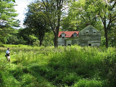
Exploring Flatbrookville: From the parking area at the 180-degree bend on Old Mine Road walk past the gate on the left and down the hill along an old farm road. Between the gate and the boarded-up farmhouse look for Hackberry and Tawny emperors. You certainly will find a few very large Hackberry trees. Sometimes the openings around the farmhouse can have a good growth of Common Milkweed and/or other nectar plants. Banded, Hickory, and Gray hairstreaks have been seen here as well as Pipevine Swallowtail. Just before following the farm road into the forest which contains some large White Pines be sure to check for Appalachian Brown on the roadside. After entering the forest be alert for Northern Pearly-eye, which is regular here. Falcate Orangetips used to be found to the right of the forest road in openings among Redcedars. This required bushwhacking to get to the Redcedars. However, most of the openings have grown in during the past several years and the butterflies have rarely been seen. You might look for orangetips in mid to late May, but be careful not to get lost. In this area their emergence seems to be synchronized with the budding of Tower Mustard, which flowers later than the plants used by the orangetips elsewhere (especially Smooth and Lyre-leaved Rockcress).
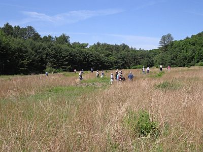
Walking farther on the farm road, you will emerge from the woods into an enormous field dominated by Little Bluestem grass. Spend considerable time here. In spring look for Eastern Pine Elfin nectaring on Cypress Spurge, American Copper (sometimes triple-digit counts), Juniper Hairstreak, and Common Ringlet. Very surprisingly, Little Yellow has been found twice in spring. Cobweb, Indian, and Dusted skippers have been found, but are rare. Both Northern and Southern Cloudywing (and seeming intermediates) also occur here, the Southern usually late May into June. In summer check the mountainmints, milkweeds, and, later, the thistles for American Copper, Juniper Hairstreak, American Snout, Common Ringlet, and Leonard’s and Crossline skippers (Crossline is fairly common; Leonard’s quite uncommon). Common Wood-Nymphs really are common in summer, and individuals of the dark form are often seen. Summer rarities that have occurred here over the years include Bronze Copper, White M Hairstreak, Aphrodite Fritillary, and Milbert’s Tortoiseshell.
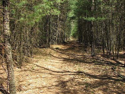
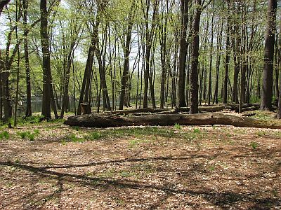
Although not likely to produce additional butterfly species, continuing on the farm road all the way to the Delaware River is a wonderful walk through a largely White Pine forest. It will take about 20-30 minutes and ends at a lovely floodplain area unreachable except by foot or canoe.
Returning to your car, you might like to make a few other stops. (1) Drive ahead, farther around the bend, 0.1 mile to the Rosenkrans area on the left. There is room to park a few cars on the left, but don't block the gate. Walk down the road past Lower Walpack Cemetery to the first abandoned buildings. Here on the left is a huge field of Little Bluestem. Walk the mowed trails through the field. This area has not been visited very often but holds promise especially for grass-skippers. Several species have been seen here including Swarthy, a rare butterfly in Sussex County. (2) Drive ahead 0.6 miles farther to a dirt road going left. Turn in and park. A rather short way down the hill is a small bluestem field on the right which is being closed in by succession. A number of years ago Cobweb Skipper, among other things, was seen here in May. This field has not been checked for several years, but warrants some visits. You can walk all the way down to a large agricultural field and wetland. This has not been visited by butterfliers in many years.
In reality, any non-agricultural field (with nectar flowers) adjacent to a paved or unpaved road in the park is worth exploring for butterflies. But note - some roads found on maps are not always well-maintained. Folks with vehicles that do not have high clearance should be very careful or walk from parking areas. It would be a good idea to view the National Park Service's Current Conditions page for any updates on road conditions and closures. Especially look at the sections labeled "Alerts" and "Temporary Area Closures in the Park".
Special precautions: Ticks can be quite common in the fields. In addition to repellent, rubber knee boots are helpful in keeping them off. Bears may be present anywhere, but they are generally happy to avoid you.
You might also want to visit: Walpack area, Blue Mountain Lakes Road & Crater Lake Road located within the Delaware Water Gap NRA, and the Appalachian Trail where it crosses Millbrook Gap.
General information about Delaware Water Gap NRA is available.
To view a larger map, click on 'View larger map' icon in upper right hand corner. (Tip: The satellite view may also suggest good potential butterfly habitat to explore.)

New Jersey Butterfly Club members exploring the main field at Flatbrookville.

Woods road near farmhouse.

Trail to river through pines.

Delaware River floodplain.