New Jersey Butterfly Club
A chapter of the North American Butterfly Association (NABA)
Appalachian Trail Lands
by Keith Richmond
County: Sussex.
Municipality: Vernon Township.
Directions: Take either County Route 515 N (accessed from NJ Route 23 in Stockholm) or NJ Route 94 N (accessed from NJ Route 23 in Hamburg) to their junction in the center of Vernon (by Burger King). Continue on Route 94 N for a bit more than a mile and reach Maple Grange Road on your left. From here, follow the directions in the Parking section.
Parking: There are 4 parking areas indicated on this Map of the area produced by the New York - New Jersey Trail Conference. To reach the south Canal Road access point, turn left onto Maple Grange Road. In about a mile (before you cross the bridge over Pochuck Creek), turn right onto narrow Canal Road following it to the lot on the left where the pavement ends at the gate. You can also park at the gate at the end of the northern section of Canal Road. Continue on Route 94 (0.7 mi.) and turn left where County Route 515 leaves Route 94 just past the point where the Appalachian Trail crosses the road. In half a mile farther, look for Bucky Lane on the left. Turn here and in 0.7 mile reach Canal Road. Turn left - the lot is on the left just before the gate. A third option is to park on Route 94 at the Appalachian Trail crossing, however this area fills sooner than others and will add about 2 miles to your hike. Finally, there is parking on County Route 517 at the point where the Appalachian Trail crosses. However, due to historically heavy parking here and the associated litter, Vernon Township prohibits most parking on 517 and all parking on surrounding residential streets on weekends and holidays. It is probably best to avoid this area unless absolutely necessary. Note that this is an extremely popular area, so expect crowds and the resulting limited parking, especially on weekends.
Nearest sizable town: Restaurants and gas stations are best found in Vernon just south of Maple Grange Road along either NJ Route 94 or County Route 515.
Habitats: The 3,000 foot wide floodplain between Wawayanda and Pochuck mountains is a complex series of habitats including wet meadows, hardwood and evergreen forest, seeps, and limestone outcrops. The most notable feature of this area is known as the Pochuck Quagmire which is the 240 acre remains of what was once a prehistoric glacial lake. This section is crossed by the 1 mile Pochuck Boardwalk and a 110 foot wooden suspension bridge over Pochuck Creek. The bridge was completed in 1995 while the boardwalk was completed in 2002. Nowadays when the normally sluggish Pochuck Creek overflows its banks, the area becomes a lake once more, with the water sometimes rising almost as high as the boardwalk.The DEP has designated the floodplain as an “Exceptional Resource Value Wetland” due to the fact that many endangered plant and animal species are supported here. Almost 200 species of birds have been seen in the area. Dogbane, common and purple milkweed, cardinal flowers, goldenrod, sneezeweed, white aster, ironweed, thistle, and cattails among many other plants and grasses can be found here.
The fertile soils here consist of unusually dark organic muck, known locally as “the black dirt”. Efforts over the years by early farmers and even the Civilian Conservation Corps to drain the “drowned lands” for farming have been largely unsuccessful. Each of the 874 metal piers supporting the boardwalk were drilled 15 to 20 feet into the muck in order to reach soil solid enough to provide the necessary support.
Maintained/Marked trails: The trails here form a kind of cross with the white-blazed Appalachian Trail running generally east/west forming the long arm of the cross and the central gated portion of Canal Road running north/south forming the short arm.
Restrooms: Restrooms are not available at any of the parking areas or trails in this area. However porta-potties are found at the 182 acre Maple Grange Community Park located on Maple Grange Road 0.4 mile west of Canal Road. Where the road bends to the right, turn left into this large municipal park with many ballfields. There are also indoor restrooms at the rear of the community building.
Picnic tables: Picnic tables are located throughout Maple Grange Community Park as well as at the community building.
Notable species: Giant Swallowtail, Banded, Hickory, and Juniper Hairstreaks, Baltimore Checkerspot, Eastern Comma, Red Admiral, Hackberry and Tawny Emperors, Northern Pearly-eye, Eyed Brown, Appalachian Brown, Common Ringlet, and Black Dash.
Best time to visit:: Early June to late July when both the Baltimore Checkerspots and Eyed Browns are active.
Exploring Appalachian Trail Lands: If you begin at the south Canal Road lot, after going a short distance north on Canal Rd, the Appalachian Trail will come in on your right. Continue straight and cross the bridge over Wawayanda Creek. The Appalachian Trail will diverge left toward the boardwalk area shortly thereafter. Beginning at the north Canal Road lot, go south on Canal Road until you reach the Appalachian Trail at which point the trail turns right toward the boardwalk. The road along this section is wide and level consisting of a mixture of grass and gravel. It is lined with trees which provide a mix of dappled sun and shade.
Beginning at the lot on NJ Route 94, you will be following the Appalachian Trail. Cross the road and climb over the stile. The trail crosses an active cattle pasture on puncheons (2 parallel 2x8 planks) due to the boggy “black dirt” found in this area. In 0.2 mile, leave the pasture and cross the railroad tracks. For the next 0.8 mile you will encounter several more stiles and puncheons as you pass through a series of fens and fields that are becoming increasingly overgrown as well as some forested areas until you reach Canal Road. Turn right, cross the bridge and in 0.1 mile reach the left turn leading to the boardwalk.
Immediately after leaving Canal Road toward the boardwalk, you will have a choice at a trail intersection. The Appalachian Trail follows the right hand branch which climbs up and over a low knob. The left hand branch stays lower and is more level - a bit less climbing but more likely to be wet. The trails re-unite in another half mile, leaving the woods upon reaching the Pochuck Quagmire and the boardwalk. In 0.2 mile reach the suspension bridge over Pochuck Creek, passing a number of benchs along the way. The boardwalk continues for another 0.7 mile from the bridge through the swamp, except for one short wooded section, until it reaches its end at County Route 517.
More information about the Appalachian Trail in this area is available.
Special precautions: Due to the many swamps, fens, and other wetlands in this area, mosquitoes can be a particular problem. Take extreme care when crossing Route 94 which has quite a bit of fast moving traffic.
You might also want to visit: Wallkill River National Wildlife Refuge (NWR) which lies 7 miles WSW of the south section of Canal Road. More information is available.
To view a larger map, click on 'View larger map' icon in upper right hand corner. (Tip: The satellite view may also suggest good potential butterfly habitat to explore.)
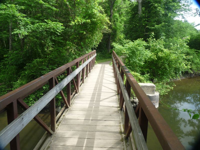
Waywayanda Creek Bridge.
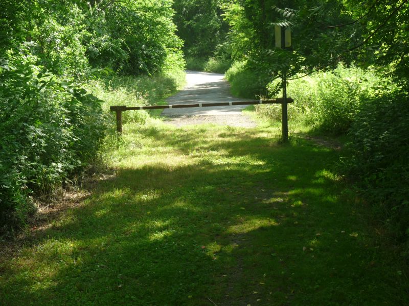
North Canal Road Gate.
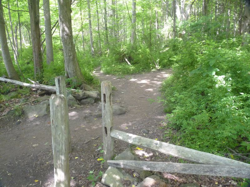
Hi Lo Trail Junction.
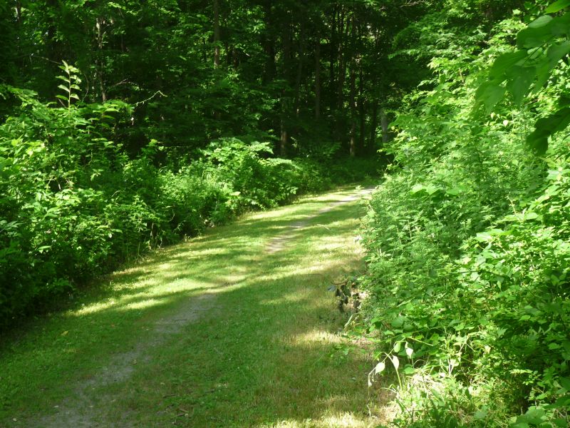
Canal Road.
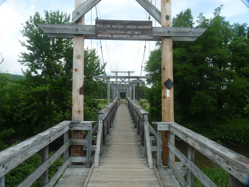
Pochuck Suspension Bridge.

Pochuck Quagmire Boardwalk.