New Jersey Butterfly Club
A chapter of the North American Butterfly Association (NABA)
Sourland Mountain Preserve
by Keith Richmond
County: Somerset.
Municipality: Hillsborough Township.
Directions:
From the north, take Interstate 287 – from the east or west, take US 22 to the Bridgewater / Somerville area. Exit onto US 206/202 south. At the Somerville “circle” where 202 and 206 split, continue south on US 206 until you reach the center of Hillsborough where the Route 206 bypass continues straight ahead and 206 exits to the right to access the commercial center of Hillsborough. Continue on the bypass until it ends (about 2.8 miles) where it rejoins route 206 at a light. At this light (there are 2 gas stations here), cross over 206 onto Mountain View Road continuing to the end of the road where you will reach East Mountain Road. Turn left and in 0.8 miles the entrance driveway will be on your right.
From the south follow Route 206 north through Princeton and Montgomery. In less than 1 mile after entering Hillsborough, you will reach the light at Mountain View Road. Continue through the light to the jug handle for Mountain View Road and follow the directions above.
Parking: Yes. A large gravel parking lot is found at the end of the entrance driveway.
Nearest sizable town: Gas stations are located at the corner of US 206 and Mountain View Road, while a deli, pizza restaurant, and a diner are found just north of this intersection. Many more options exist several miles north in Hillsborough and south in Montgomery Township.
Habitats: The 6,358 acre mostly wooded Sourland Mountain Preserve is owned by the Somerset County Park Commission. The Preserve provides passive recreational opportunities in an undisturbed natural setting. Sourland Mountain is a mostly forested diabase rock outcropping rising to a height of just over 500 feet. The preserve is bisected by the Texas Eastern gas pipeline.
Maintained/Marked trails: Yes. A trail map is available. The trail which climbs the mountain following the pipeline cut provides the best butterfly habitat. Follow this trail to the top and return as you came, unless you prefer to explore one of several intersecting trails in search of birds or other woodland species. Please note that Black Cohosh, the foodplant for Appalachian Azure caterpillars may be found as a tall understory plant along some of the woodland trails.
Restrooms: Porta-A-Johns can be found next to the kiosk in the parking lot.
Picnic tables: No.
Notable species: Banded Hairstreak, Hickory Hairstreak, Red-banded Hairstreak, Appalachian Azure, Great Spangled Fritillary, Hackberry Emperor, Appalachian Brown, Dreamy Duskywing, Little Glassywing and Pepper and Salt Skipper.
Best time to visit: Mid-May through Mid-July corresponding with the bloom of both the indian hemp (dogbane) and milkweed found in the pipeline cut.
Exploring Sourland Mountain Preserve: From the main parking lot, head south around the east (left) side of the pond following a gravel road. Pass a metal gate and you will come to the right-of-way for the pipeline. The lower third or so of the trail here is level but sometimes a bit wet. These wet areas attract azures, duskywings and a variety of skippers. The next third begins a gradual climb of the mountain while the last third becomes steeper as you approach the top. There is a bench here where you can pause to catch your breath.
Three years of maintenance on the pipeline involving the use of heavy contruction vehicles completed in 2021 took a heavy toll on the nectar sources on the area below the bench. The most indian hemp and milkweed is to be found beyond this point. The trail proceeds slightly downhill to a small stream crossing, then rises moderately eventually reaching the end of the formal trail where it is crossed by the red-blazed Ridge Trail. Bushwacking beyond this point is not productive so turn around here and retrace your steps back to the parking lot.
Special precautions: The lower portion of the trail can be wet and muddy in spots – proper footwear is advised. Once the trail begins to climb the mountain, several sections are fairly steep and somewhat rocky.
You might also want to visit: Duke Farms.
Further information about Sourland Mountain Preserve is available.
To view a larger map, click on 'View larger map' icon in upper right hand corner. (Tip: The satellite view may also suggest good potential butterfly habitat to explore.)
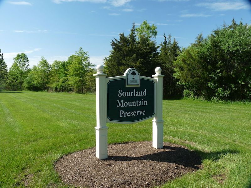
Sourland Mountain Preserve sign.
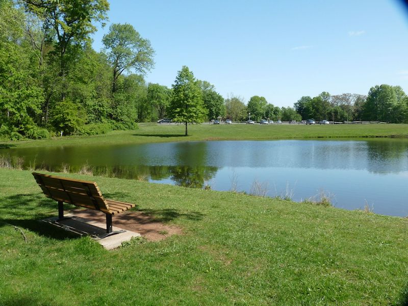
Sourland Mountain Preserve pond and main parking lot.
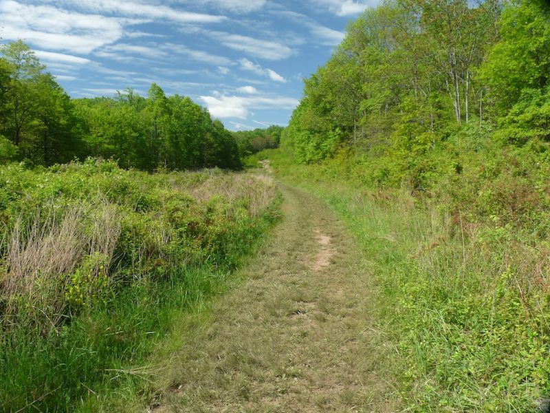
Sourland Mountain Preserve pipeline trail uphill looking southwest.
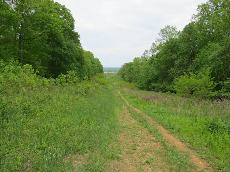
Sourland Mountain Preserve pipeline trail looking northeast.