New Jersey Butterfly Club
A chapter of the North American Butterfly Association (NABA)
Mercer Meadows
by Keith Richmond
County: Mercer.
Municipality: Lawrence & Hopewell Townships.
Directions: From Princeton: Take US 206 south for 4.8 miles until you reach Cold Soil Road just as you enter Lawrenceville. At this traffic light, turn right. In 0.8 miles at the intersection with Keefe Road, the Pole Farm District will be on your left.
From Flemington: Take US 202/NJ 31 south. When 31 and 202 split, continue on NJ 31 for 10 miles until you reach the traffic circle just south of Pennington. Drive to the east side of the circle and turn right at Wilson-Apple Funeral Home onto Route 546 East. Proceed to the first intersection at traffic light (0.7 miles) and turn right where Route 546 becomes Lawrenceville - Pennington Road, then in 1.5 miles farther, turn left at the light onto Keefe Road (large sign for Mercer Meadows on your left here). Follow this for 1.2 miles where it ends at Cold Soil Road – entrance to Pole Farm District is on your left.
From Trenton and south: Take Interstate 295 to US 206 north. Drive 1.2 miles through Lawrenceville – turn left at the light onto Cold Soil Road then 0.8 miles to the Pole Farm.
To the Equestrian District: Starting at the Pole Farm District, as you exit the parking lot, turn hard right onto Keefe Road. When you reach the traffic light, turn right onto Lawrenceville-Pennington Road. At the next light, turn right onto Federal City Road. Continue on, passing Blackwell Road, until you reach the entrance to the Rosedale Park District where the road bends sharply left. Continuing on Federal City Road, the Equestrian District is just ahead on your left.
Parking: There are 4 parking areas providing access to various portions of the Pole Farm and Farm History Districts where some of the best butterflying is found. The directions above lead you to the lot next to a large red barn at the southeast portion of the Pole Farm District at the intersection of Cold Soil and Keefe roads. The property is bounded by Keefe Road to the south, Cold Soil Road to the east, Blackwell Road to the north, Federal City Road to the west and Lawrenceville - Pennington Road to the southwest. The lot on Blackwell Road provides access from the north, the lot on Federal City Road provides access from the west (at the Reed-Bryan Farm), and the lot on Keefe Road provides access from the southwest.
This trail map shows the road network and available parking.
Nearest sizable town: Lawrenceville, where you will find several restaurants and a gas station along US 206.
Habitats: Mercer Meadows consists of 1,619 acres, divided among five separate districts (Pole Farm, Farm History, Equestrian, Rosedale Park, and Ecological). The Pole Farm and adjacent Farm History Districts, are an 812 acre tract formerly owned by AT&T. 435 of these acres have been converted to meadows with native grasses and wildflowers to benefit grassland organisms, such as native pollinators and grassland birds. The balance of the property remains forested.
Maintained/Marked trails: Yes. Over 12 miles of stone dust, paved and grass trails exist which provide the opportunity for loop hikes of various lengths. The trails are all flat and level – boardwalks traverse the wettest areas – benches, observation towers and blinds are scattered throughout the property. A trail map produced by the New Jersey Trails Association is available.
Restrooms: Yes. Waterless composting toilets are found at the Reed-Bryan Farm parking area and at the Pole Farm Interpretive Site which is a 5 minute walk north of the Pole Farm parking area. Restrooms are also available at the Hunt House located on Blackwell Road which is the headquarters of the Mercer County Park Commission.
Picnic tables: There are 2 picnic tables and a covered pavillion (no seating) at the Reed-Bryan Farm parking area, 2 picnic tables and 4 benches at the Pole Farm Interpretive site, and 2 picnic tables each at the Keefe Road, Blackwell Road and Hunt House parking lots. In addition numerous picnic tables, benches and a covered pavilion can be found in the Rosedale Park District.
Notable species: Over 50 species of butterflies have been found on the site including Pipevine, Black, Eastern Tiger, and Spicebush Swallowtails, Cloudless Sulphur (fall), Coral, Striped, Gray, and Red-banded Hairstreaks, Eastern Comma, American and Painted Ladies, Common Buckeye, Red-spotted Purple, Viceroy, Monarch, and at least a dozen species of Skippers.
Best time to visit: Anytime from April through October, with mid-May to mid-September being peak season.
Exploring Mercer Meadows: Taking a clockwise loop of the trails here is the best way to explore the Pole Farm and Farm History Districts. After exploring the meadows in the area of the Pole Farm parking area, take the trail north. You will quickly reach the Lawrence-Hopewell Trail. Turn left here and take the trail through the tree line following the signs which point you to the Reed-Bryan farm. Where the Lawrence-Hopewell trail turns left, continue straight on the Twin Pines trail which, after traversing a field with an observation tower, enters the woods and reaches the Maidenhead Trail.
Turn right towards the Reed-Bryan farm which is located in the Farm History District. Continue straight through a wooded section until you reach the boardwalk and the meadows of the Farm History District, turn right, pass a second observation tower, and you will come to a trail on your left that leads to the Reed-Bryan farm. After exploring the area around the farm, return to the loop trail. You can either turn left on an old road, keeping the tree line on your right, or turn left on the grass trail keeping the trees on your left. Follow either of these until you come to the Transco Gas Pipeline.
Turn right, following the old road until you reach the short stone dust trail on your left leading to the Blackwell Road parking lot. Continue straight on the old road. In a short distance the road makes a 90 degree turn to the right. Continue on until you reach the paved Lawrence Hopewell Trail that joins from the left. Continue straight on the paved path and return to the Pole Farm parking area.
While taking the loop described above, turning left at each trail intersection you encounter will present an opportunity to explore another of the many meadows found here. In addition, if time or inclination does not permit you to take the entire loop, the several parking areas here will allow you to take one or more out and back hikes of your choice.
Finally, no visit to Mercer Meadows would be complete without a visit the Mercer County Master Gardeners' Educational Gardens located in the Equestrian District which features seven display gardens, a wetland meadow restored with native grasses and wildflowers, and more than 20 composting methods for home use. This relatively small area attracts a surprisingly large number of butterfly species.
Special precautions: The trails here are wide and reasonably tick free, but insect repellent is always a good idea.
You might also want to visit: The Watershed Institute located at 31 Titus Mill Road, Pennington approximately 5 miles north northwest of the entrance to the Pole Farm section of Mercer Meadows.
Further information about Mercer Meadows is available.
To view a larger map, click on 'View larger map' icon in upper right hand corner. (Tip: The satellite view may also suggest good potential butterfly habitat to explore.)

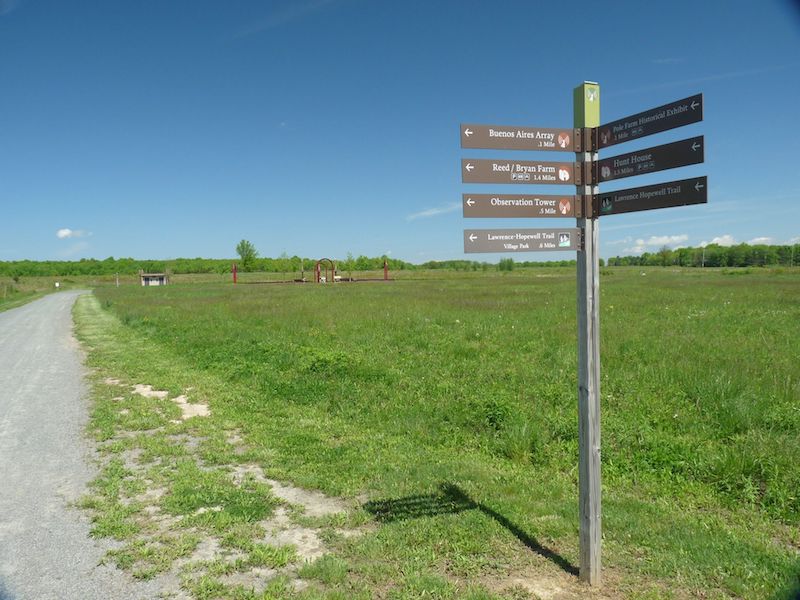
Mercer Meadows Cold Soil Road entrance.
Mercer Meadows Pole Farm District.
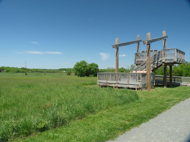
Mercer Meadows observation tower.

Mercer Meadows Farm History District.
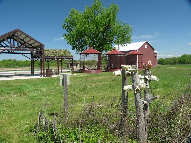
Reed Bryan Farm structures.
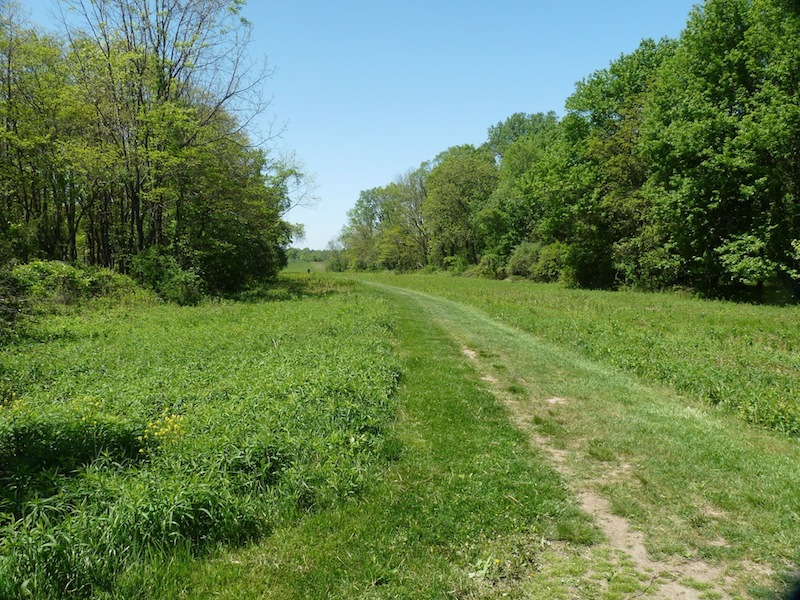
Blackwell Road pipeline.